Many truckers rely on GPS, but for you the best system delivers accurate truck-specific routing, live traffic and weather updates, and warnings for low bridges and weight-restricted roads; you should prioritize devices that integrate firm map updates, ELD/HOS compatibility, and robust offline maps so your routes stay safe and compliant, and choose a unit with long battery life and easy mounting to keep your focus on the road.
Key Takeaways:
- Pick a truck-specific GPS that enforces truck-routing rules (height, weight, hazmat, bridge/road restrictions) rather than a standard car navigator.
- Prioritize features: accurate truck routing, real-time traffic, offline maps, truck stops/WEIGH station POIs, clear voice guidance and a large, mountable display.
- Match the solution to your operation: portable units for owner-operators, integrated fleet/ELD-capable systems for fleets; factor in map-update frequency, support and total cost of ownership.

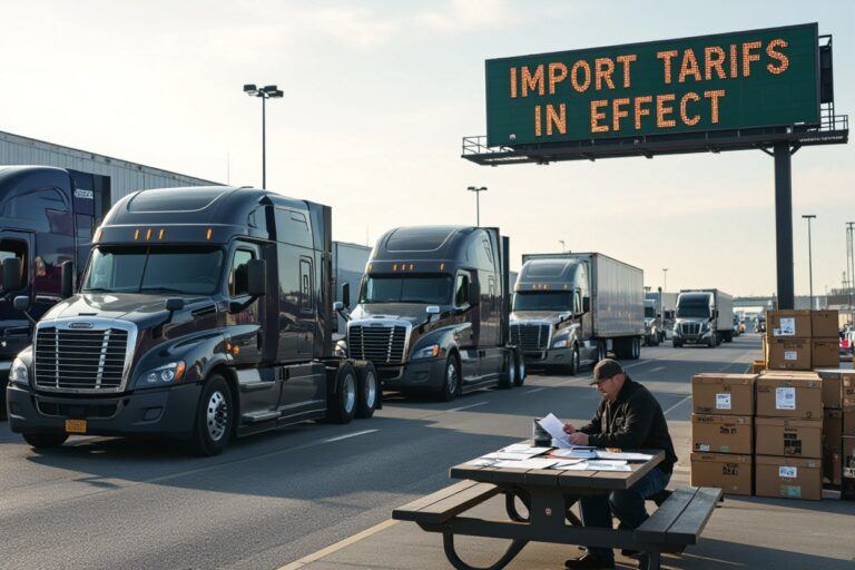
The Necessity of GPS in Trucking
You rely on GPS to prevent costly errors and keep loads on schedule: advanced units integrate ELD data, traffic updates and carrier-specific restrictions so you avoid low bridges, weight-restricted routes and time‑sensitive delays. Fleets using dedicated truck GPS report measurable drops in reroutes and missed deliveries, and integration with dispatch platforms shortens turnaround time at terminals by measurable margins.
Safety and Navigation Benefits
Modern truck GPS gives you lane guidance for tight interchanges, alerts for low-clearance and weight-restricted roads, and HAZMAT-aware routing so hazardous loads avoid tunnels and populated corridors. Real-time warning of steep grades and sharp curves helps reduce brake fade and rollover risk; industry data links these features to fewer on-road incidents and lower insurance claims for fleets employing truck-specific navigation.
Impact on Efficiency and Fuel Costs
Route optimization and live traffic avoidance cut miles and idle time, delivering typical fuel savings of 5–15%; telematics pairing further trims empty miles by up to 10%. You see faster turnarounds and reduced driver overtime when routes are optimized for permitted hours and realistic arrival windows, directly lowering operating cost per mile.
If your truck runs 100,000 miles at 7 mpg you use ~14,285 gallons; at $4/gal that’s about $57,140 in fuel. A conservative 10% cut saves roughly $5,700 per truck per year. Added savings from less wear, lower maintenance and fewer detours mean GPS hardware and subscription—typically $30–$60/month—often pay back within 6–12 months for many carriers.
Key Features Truckers Should Look For
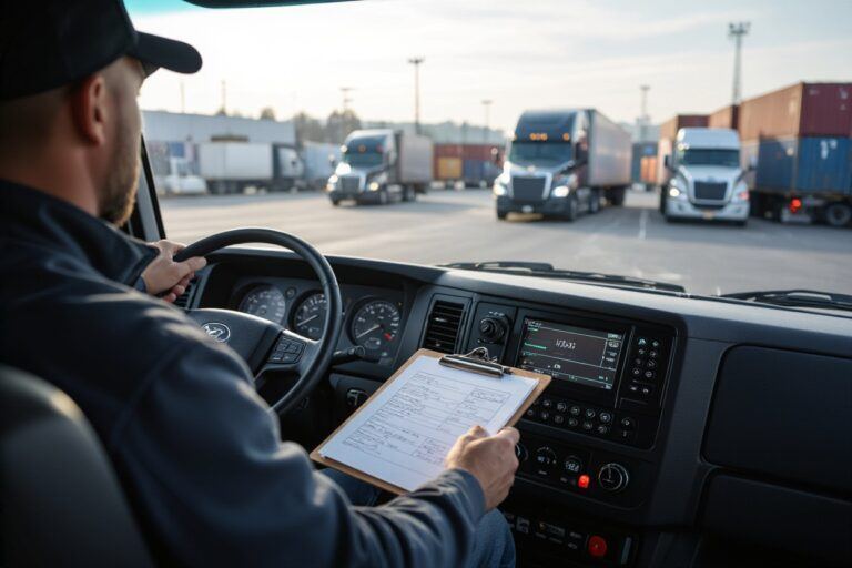
Every trucker needs GPS that handles truck-specific routing, enforces weight/height restrictions, and integrates HOS/ELD data so you avoid fines and unsafe roads. Choose units with monthly map updates, real-time traffic and offline maps for dead zones, plus rugged hardware with long battery life. Prioritize clear lane guidance and low-clearance alerts that trigger well before exits. After testing devices on a typical 200–500 mile run to validate ETA and restriction handling.
- Truck-specific routing — routes based on truck class, axle count, and cargo type to avoid forbidden roads.
- Weight/height & HAZ restrictions — automated avoidance of low bridges, tunnels, and hazmat-prohibited routes.
- Route optimization & live traffic — multi-stop optimization with live reroutes to reduce drive time and idle delays.
- Offline maps & frequent updates — local maps for rural areas plus weekly or monthly refreshes.
- HOS/ELD integration — syncs hours, logs, and break planning to prevent violations.
- Lane guidance & junction views — high-detail arrows and 3D junction imagery for complex interchanges.
- Voice navigation & hands-free controls — natural-language prompts and wake-word activation for safe operation.
- Bluetooth & smartphone integration — call routing, music control, and app handoff without distractions.
- Truck-specific POIs — truck stops, weigh stations, certified scales, and fuel prices tailored to rigs.
- Driver alerts & incident reporting — real-time road hazards, weather warnings, and crowd-sourced incident feeds.
- Fuel-efficiency routing — route choices that factor rolling terrain, speed, and idling to save fuel.
- Rugged hardware & battery life — IP-rated units, glove-friendly buttons, and long run times for long hauls.
Route Optimization and Traffic Updates
Advanced systems combine historical patterns and live feeds to predict congestion up to 30 minutes ahead and recalculate routes in under 10 seconds, giving you accurate ETAs and break windows. Multi-stop optimization can reduce deadhead and drive time on dense routes, and predictive lane modeling helps avoid bottlenecks; in operator pilots, smart reroutes trimmed urban delays by about 15%. You should verify reroute behavior on typical runs and during peak hours.
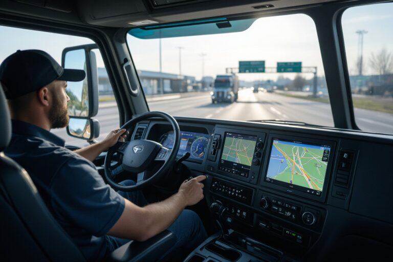
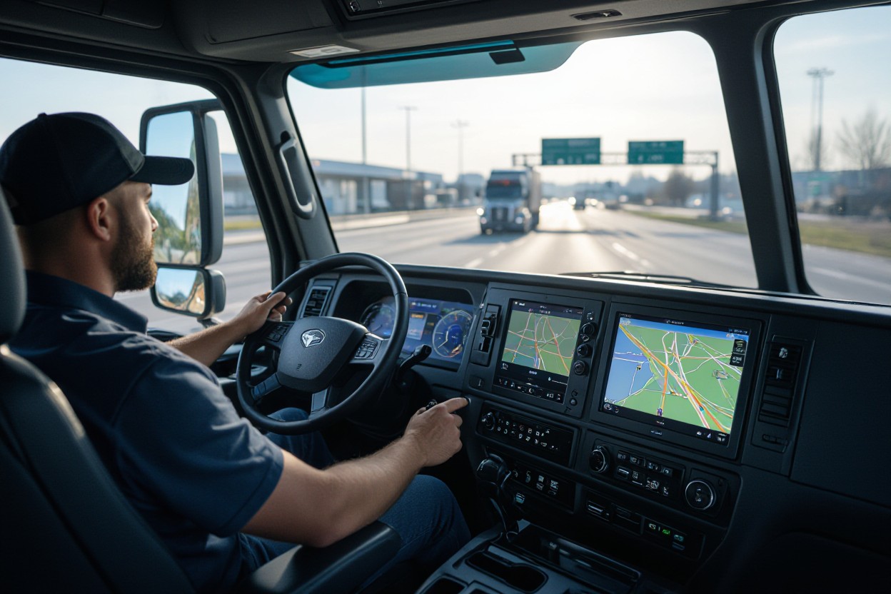
Driver-Friendly Interface and Voice Navigation
Choose displays >= 7 inches with high-contrast night mode and large touch targets so you can glance, not squint, while driving. Natural-language voice prompts that announce restrictions, upcoming lane changes, and HOS reminders let you keep hands on the wheel; latency under 300 ms keeps guidance timely. Look for customizable volumes and languages to match your cab environment.
Modern truck GPS UIs combine a 7–10 inch anti-glare touchscreen (some models offer 500+ nits brightness) with physical, glove-friendly controls for coarse inputs; you get tactile safety when gloves or bumps make touch unreliable. Voice stacks use offline TTS plus cloud-assisted updates so prompts work in dead zones and sound natural. Expect lane guidance arrows that preview maneuvers 0.5–1 mile ahead, split-screen options showing maps plus HOS timers, and configurables that highlight low-clearance or weight-restricted warnings in red with audible escalation. Integration with Bluetooth headsets, steering wheel buttons, and wake words minimizes distraction and shortens reaction time when a reroute or restriction appears.
Top GPS Options for Professional Truckers
You can choose rugged in-cab navigators or smartphone-based solutions depending on budget and fleet needs; models like the Garmin dezl OTR1000 and Rand McNally TND 740 give large 7–10″ screens, truck-profile routing, and ELD pairing, while apps such as CoPilot Truck and Trucker Path deliver portable routing and crowd-sourced parking data—combine gear and apps to cover gaps in lane guidance, traffic, and low-bridge/height warnings.
High-End GPS Systems Reviewed
Garmin and Rand McNally units offer purpose-built features: multi-stop planning, 3D junction views, lifetime map updates, cellular traffic and weather, and direct truck-attribute routing based on height, weight, length, and hazmat restrictions. You’ll get responsive 7–10″ touchscreens, rugged mounts, and fleet-management integration (ELD and dispatch) that reduce reroutes caused by restricted roads and improve on-time performance for high-mileage drivers.
Budget-Friendly Alternatives
Smartphone and tablet apps keep costs low: CoPilot Truck and Sygic Truck provide offline maps and truck-profile routing, while Trucker Path excels at parking, weigh-station, and truck stop crowd-sourcing. Expect initial costs from free to about $60/year; pair with a sturdy mount and external antenna to approach the reliability of a dedicated unit, though ruggedness and integrated hardware features will be limited.
For practical saving, use a two-tier setup: run a dedicated app like CoPilot or Sygic for primary truck routing (offline maps, height/weight settings) and Trucker Path for live parking/scale intel; invest $20–$50 in a heavy-duty mount and $50–$120 in an external GPS/GLONASS antenna to improve signal. That combo delivers most route safety features at a fraction of the $500–$1,500 price of premium in-cab systems while keeping you aware of low bridges, restricted turns, and available parking.

Real-World Performance Comparisons
Performance Snapshot
| Route accuracy & rerouting | Garmin dezl models show fewer off-route corrections on interstate runs; Sygic and TomTom perform well in urban areas but can misroute if truck dimensions aren’t set. |
| Truck-specific restrictions | Rand McNally TND and Garmin dezl enforce height/weight limits reliably; mobile apps without truck profiles risk low-clearance or weight-restricted detours. |
| Offline performance & maps | Sygic’s offline maps keep navigation stable in low-signal zones; devices with preloaded maps avoid cellular delays on long rural hauls. |
| Integration & telematics | Rand McNally and TomTom offer stronger fleet integrations (ELD, dispatch) than standalone consumer GPS units, improving route adherence for fleets. |
| Durability & hardware | Dedicated truck units (Garmin dezl, Rand McNally TND) use rugged housings and shock-resistant mounts versus fragile consumer tablets. |
User Feedback on System Reliability
Drivers report Garmin dezl 7″ units consistently handle long-haul interstate routing with stable lane guidance, while Rand McNally users praise regular map patches and fleet sync. Sygic and TomTom apps get high marks for city navigation but occasionally produce truck-incompatible turns if truck dimensions are misentered. You should test any system on your common routes for a week to spot recurring misroutes or delayed reroutes before committing fleet-wide.
Analyzing Long-Term Value and Support
Buying decisions hinge on warranty, update policy, and recurring costs: Garmin offers models with lifetime map updates on select units, whereas Sygic and TomTom often use annual subscriptions for fresh maps and traffic. Manufacturer warranties typically span 1–3 years; premium fleet packages add priority support and integration help. You need to weigh upfront hardware cost against multi-year subscription fees and expected firmware updates for safety-critical routing.
For example, a $300 device plus a $50/year subscription totals about $550 over five years, while a $450 unit with included lifetime maps avoids ongoing map fees and may be cheaper long-term. Fleet deployments should factor in support SLAs, spare-unit policies, and integration setup fees—these often determine true total cost of ownership more than the sticker price.
Future Trends in Trucking GPS Technology
Expect GPS systems to become part of a larger connected stack: 5G and LEO satellites will cut latency and improve coverage, edge AI will run local routing decisions, and tighter telematics standards will let you fuse engine, cargo and traffic data in real time. Watch for increased focus on cybersecurity—GPS spoofing and data breaches remain the top operational risks as systems grow more interconnected.
Integration with ELD and Fleet Management
Your GPS should natively ingest ELD telematics and CAN/J1939 engine metrics to automate hours-of-service (HOS), fuel usage, and maintenance alerts. Since the FMCSA ELD mandate (Dec 18, 2017) fleets have used APIs to push live location and fault codes into TMS platforms, enabling automated dispatching, predictive maintenance triggers, and compliance reporting without manual log reconciliation.
The Role of AI and Machine Learning
AI-driven routing and ETA models can factor in historical traffic, weather, weight limits and driver behavior to cut miles and idle time; UPS’s ORION project, for example, reportedly saved about 100 million miles per year and substantial fuel costs using advanced routing algorithms. Machine learning also personalizes coaching to lower fuel burn and improve safety across your fleet.
More advanced ML workflows run anomaly detection on telematics streams to predict component failures before they strand you, with pilot programs showing 20–40% reductions in unscheduled downtime. Edge inference handles latency-sensitive tasks (braking alerts, rollovers) while cloud models update global routing patterns; be aware that model drift and biased scoring can penalize drivers unfairly, so you should audit models and keep human review in the loop.
To wrap up
Following this, the best GPS for truckers is the one that aligns with your truck’s dimensions, cargo limits, and preferred features; many professional drivers choose the Garmin dezl series for its reliable truck-specific routing, robust maps, and user-friendly interface, while others favor Rand McNally for fleet integration and odometer accuracy. You should prioritize accurate truck routing, frequent updates, and responsive customer support to keep your routes safe, legal, and efficient.
FAQ
Q: What features define the best GPS system for truckers?
A: The best truck GPS prioritizes truck-specific routing (routes that account for height, weight, length, and hazmat restrictions), customizable truck profile settings, up-to-date commercial maps, and live traffic/road-closure alerts. Additional important features are lane guidance and clear turn-by-turn voice prompts, calibrated ETA for large vehicles, truck-friendly POIs (weigh stations, scales, rest areas, truck stops), offline map capability, and reliable map updates. Integration with ELDs, routing platforms, or fleet-management systems and durable, readable hardware (large touchscreen, glare-resistant, secure mount) are also key.
Q: Which GPS devices and apps are top choices for truck drivers?
A: Popular dedicated units include Garmin dezl series (robust truck-routing, clear interface), Rand McNally TND series (fleet features, route planning, detailed truck POIs), and TOMTOM Trucker (where available). Leading apps are CoPilot Truck (offline maps, strong truck-routing), Sygic Truck GPS Navigation (detailed truck profiles, offline maps), and Trucker Path (excellent community-sourced POIs and parking info). Choice depends on needs: dedicated devices suit drivers who want a standalone, rugged unit; apps are good for low-cost, frequently updated maps and community features; enterprise fleets often use integrated telematics solutions.
Q: How should a trucker choose and set up a GPS system?
A: Steps: 1) Define priorities—solo vs. fleet, need for ELD/dispatch integration, offline use, budget. 2) Verify truck-routing capabilities—ensure the unit/app accepts vehicle dimensions, weight, and cargo type. 3) Check map quality and update policy—frequency, cost, and ease of updates. 4) Test route accuracy and alternatives on sample hauls. 5) Configure profiles (height, weight, hazmat), enable live traffic if needed, and input preferred POIs (preferred truck stops, maintenance shops). 6) Mount and position the device for visibility without obstructing sightlines; confirm voice prompts are audible. 7) Keep firmware and maps current, and periodically cross-check GPS routing against official regulatory restrictions and broker/shipper instructions.